


Coe Operations World Flags is a test and training app to improve your knowledge of the world's flags, capital cities and your ability to place countries on a map. It includes links to Kiddle (Kids Encyclopedia Facts) or Wikipedia for further information and is designed to be as intuitive as possible.
The Android installer has been temporarily withdrawn until repackaged with smaller image files. Click the icon above to play in your web browser.

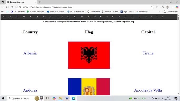
Countries may be filtered by continent, which can be selected by tapping or clicking the menu bar buttons at the top. The default option is the whole world. Your selection is saved for launching next time in the Android app or your web browser's local storage.


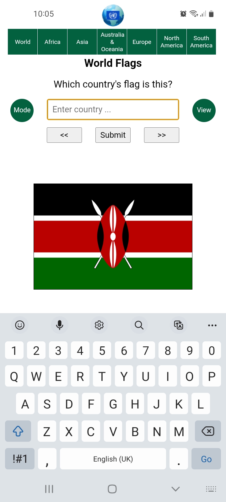
There are two views, Flag View and Map View where you can learn or test your knowledge of different countries' locations. Click the button to switch views except in Flash Test Mode.
The soft keyboard is hidden on tablets and phones in map view for visibility during tests. Tap the input field to activate and once more if you wish to hide the Option List.


There are two modes, Display Mode that shows countries and their capital cities and Test Mode. Display Mode comprises hyperlinks from the flags, maps and capital cities to their respective Kiddle (Kids Encyclopedia Facts) or Wikipedia pages. Kiddle is the initial option for juniors, toggle the bottom right hand button for Wikipedia.
Display Mode has a Play button to move on every five seconds, so the screen stays on because of its slideshow characteristics in the Android app and in some browsers on mobiles. Do not leave your device unattended as it could drain the battery. You will be asked however whether you are still watching after 10 minutes of inactivity.
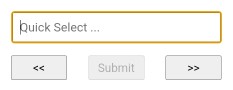
You can type single characters with Quick Select to jump to countries beginning with that letter or the next available option, rolling over to the first if there are none. You may use the Option List if you prefer to go straight to your chosen destination. Backward and forward buttons are also provided for navigation; the Left and Right Arrow keys can be used instead when viewing on a computer.
Maps are best viewed by continent in Display Mode as it effectively fixes the map with no movement or varying sizes.
World Flags launches in whichever mode was last used if local storage has been granted. Click the Mode button to cycle between them.
There are two primary test modes for testing your knowledge of country flags or locations, just switch view for either. Switching is discouraged during tests however but can sometimes help as a prompt if you're stuck.

There are four further test options, 10 random questions or all countries in your chosen continent, a City option for testing your knowledge of capital cities plus Flash and Timed Tests for accomplished users wanting an extra challenge.

Flash Test Mode where flags are flashed up for one tenth of a second or maps for a half is unavailable for city tests. Timed Tests have been requested but not yet implemented so its button is currently disabled.
The final button is not actually a test button but as stated above is for choosing between Kiddle and Wikipedia for information on countries or their capitals.
Correct solutions are shown after three wrong answers and shall be asked again. You may skip or go back to earlier questions as you please, but it does reset the question's wrong answer counter before its solution is shown.
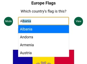
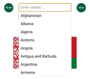
Typing is the preferred input method. Options beginning with entered text are filtered and autocompleted as you type, as shown above and in the following image. Since options are limited to those in the list, you are audibly warned when none exist, most likely the result a typing error, and the offending character is removed. Just accept the free hit if it wasn't a typo.

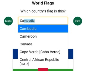
Press Enter/Go or the central Submit button once filtered to the first or last remaining option, as shown above, to submit that as your answer. No further typing is necessary. Use the Backspace key as usual to correct mistakes.
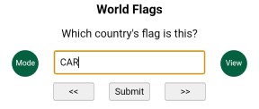
Abbreviations are accepted in several cases too, CAR for Central African Republic for example, St for Saint, although Saint Vincent and the Grenadines already has a recognised abbreviation, SVG. Where applicable they are enclosed within square brackets in the Option List.
Typing the letter 'r' completes the abbreviation, which in this case filters out the remaining options. The above example also illustrates a further feature of input, case-insensitivity.
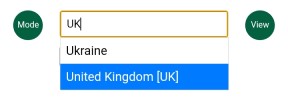
The UK is a special case where its abbreviation does not filter to a single option but is selected since it is complete. You may therefore press the Enter/Go key to submit or continue typing to filter it out.
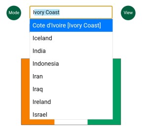
This facility has also been used for alternative inputs such as Ivory Coast for Cote d'Ivoire. You can find them all by scrolling the full list.
Selection can also be made by directly interacting with the Option List itself. Tap or click the input field at any time to show or hide it. Nothing is displayed where no options match the text in the input field, whereas all are available when there is none.
The list can be swiped as usual on touch screens or scrolled with the mouse wheel on computers. Items are selected by tapping or clicking them. Press the Submit button or the Enter/Go key to submit your answer. Of course you may use a combination of typing and the Option List.
The Down Arrow key can also be used on computers to activate the option list if hidden. Use the Up and Down keys to scroll and dynamically make selections, then press Enter when ready. This can also be done in Quick Select mode.
As stated above, hyperlinks for further information are provided to Kiddle or to Wikipedia in Display Mode, with Kiddle being the default for juniors. Whichever you choose is saved in the Android app and, if permitted, in your web browser's local storage. Also saved for launching next time are what settings you were using and whether you closed during a test. If you have more correct answers than mistakes you will be asked whether you wish to resume next time you launch the app.
World Flags is the natural progression from a spreadsheet of European flags created years ago for my granddaughter and her primary school by her father, comprising hyperlinks to maps and Kiddle. When asked for an opinion, I copied it to a simple web page as shown above.
I don't know how much it spurred her interest in flags and geography, but she can now identify most in a flash and asked for a flags test with maps on her phone while I was coding something else for personal use.
Bug fixes or additions in the latest release.
06/04/2026
Updated: Repackaged map files as jpg for smaller file sizes.
13/03/2026
Fixed: Disabled test buttons with large maps.
06/03/2026
Updated: New layout for computer screens in landscape view.
Updated: Buttons with images rather than text.
Added: New test option buttons.
Updated: Improved reliability of audible feedback.
18/02/2026
Fixed: Issue with input, especially after backspacing.
13/02/2026
Added: Option List unique property; non-unique items can be multi-indexed.
Updated: Progress bar and timer reset when following links in Rolling Display Mode.
Updated: Maps properly accredited.
Fixed: Input re-enabled when changing mode, continent or test type when showing
correct answer.
Fixed: Extra long header in portrait view for Australia & Oceania Capital City test.
Updated: Capital city question placed higher up page.
08/02/2026
Updated: Resized buttons to accommodate translated text.
05/02/2026
Added: Tests saved in local storage for resuming at next launch.
Added: ID or index field to Option List items.
Allowed: Numerals no longer excluded from input to facilitate Unicode characters
when using a computer in a foreign language.
Updated: Fixed and Rolling Display Modes combined into one since introduction of
the Play/Pause button.
11/01/2026
Fixed: Option list resized for small screens.
10/01/2026
Added: Selected continent in user preferences.
09/01/2026
Added: Flag/Map View included in user preferences.
07/01/2026
Added: User preferences to Android app and web browser if permitted
(Kiddle/Wikipedia & launch in Display/Test Mode).
29/12/2025
Added: Pause/Restart button in Rolling Display Mode (switches mode without reset).
26/12/2025
Fixed: Resizing issue when using keyboard on iPhones.
24/11/2025
Added: Year flag adopted.
Added: Loading resource spinner after 2 second delay.
Added: Unicode to ASCII character conversion instead of separate display
and input strings.
Fixed: Showing soft keyboard for first question in Flag tests.
15/11/2025
Updated: Improved maps layout on mobile devices and larger images in the
Android app.
12/11/2025
Updated: Improved Option List efficiency and replaced the old pixellated Coe
Operations logo (from a Windows Installer banner) as the original was lost.
13/10/2025
Added: Single key press selection (Quick Select) in both display modes.
12/10/2025
Fixed: Showing Option List first time it is clicked or Down Arrow pressed.
09/10/2025
Fixed: Flicker progressing from scaled flags.
06/10/2025
Fixed: Showing previous country from second image.
05/10/2025
Added: Kiddle hyperlinks.
Adapted: Buttons to toggle test size, country/city test and Kiddle/Wikipedia links.
04/10/2025
Added: Hyperlinks from capital cities to their respective Wikipedia page.
Added: Mini progress bar in Rolling Display Mode.
Removed: Navigation by input in Rolling Display Mode as progressing on
phones interfered with using the virtual keyboard.
29/09/2025
Fixed: Window movement when Option List item scrolled into view on Android
devices with virtual keyboard showing.
Fixed: Autocompletion fully implemented now window movement fixed.
Fixed: Backspace removes last input character as well as autocompleted selection.
Added: Image hyperlink to Wikipedia page in Fixed Display Mode.
Added: Backward navigation during tests.
Added: Navigation by input in Display Modes.
Added: Two more flags.
Allowed: Switching between Flag and Map Views during tests.
Removed: Input error messages; kept the audible warnings.
Now links to further information have been implemented, the United Nations has been added to the app, as almost without exception it comprises its members or recognised states. Also included is the European Union, which like the UN, is a supranational organisation founded on the collaberative co-operation of its members.
Barring the updated Syrian Revolution Flag, all flags have been sourced from Flagpedia.net.
All maps, with minor edits, are sourced from Wikimedia Commons, a vast collection of free to use resources.
You are free to use and distribute this software or web package provided it is accredited and supplied in its entirety with no alteration and that no fee is charged. All source code remains the property of Coe Operations.
© Coe Operations June 2025